699
1986
1983 2 Karten. Russland.
1985 Russland. 1984 Russland.
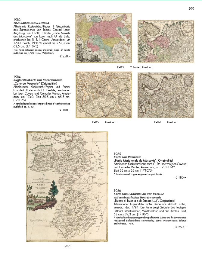
1983
Zwei Karten von Russland
Altkolorierte Kupferstiche/Papier. 1 Gesamtkarte
des Zarenreiches von Tobias Conrad Lotter,
Augsburg, um 1760; 1 Karte „Carte Novelle
des Moscovie“ von bzw. nach G. de L‘isle,
erschienen bei R. & I. Ottens, Amsterdam, um
1730. Besch.; Blatt 50 cm-53 cm x 57,5 cm-
63,5 cm. (171075)
Two hand-coloured copper-engraved maps of Russia
published ca. 1730-1760. Major flaws.
€ 250,–
1985
Karte von Russland
„Partie Meridionale de Moscovie“. Originaltitel
Altkolorierte Kupferstichkarte nach G. De l‘isle von Jean Covens
und Corneille Mortier, Amsterdam, um 1733-1742.
Blatt 56 cm x 65 cm. (171075)
A hand-coloured copper-engraved map of Russia.
€ 180,–
1986
Karte vom Baltikum bis zur Ukraine
mit westrussischen Gouvernements
„Ducati di Livonia e di Estonia (...)“. Originaltitel
Altkolorierter Kupferstich/Papier. Karte von Antonia Zatta,
Venedig, dat. 1784. Die Karte zeigt Gebiete des heutigen
Lettland, Westrussland, Weißrussland und der Ukraine. Blatt
53 cm x 39,3 cm. (171075)
A hand-coloured copper-engraved map of Estonia, Livonia and the governorates
Nowgorod, Bialgorod and Kiew in today‘s Latvia, Western Russia, Belarus
and Ukraine, 1784.
€ 250,–
1984
Kupferstichkarte von Nordrussland
„Carte de Moscovie“ (Originaltitel)
Altkolorierter Kupferstich/Papier, auf Papier
kaschiert. Karte nach G. Deslisle, erschienen
bei Jean Covens und Corneille Mortier, Amsterdam,
um 1740. Blatt 55,5 cm x 65,5 cm.
(171075)
A hand-coloured copper-engraved map of Northern Russia
published ca. 1740.
€ 180,–