648
1918
1918
1917
1917
1916
1916
1916
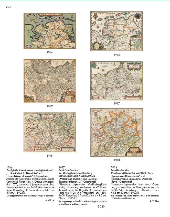
Zwei frühe Landkarten von Ostfriesland
„Frisiae Orientalis Descriptio“ und
„Typus Frisiae Orientalis“ (Originaltitel)
Altkolorierte Kupferstiche. Historisch bedeutende
Karten von J. Florianus bei A. Ortelius, Antwerpen,
dat. 1579, sowie von J. Janssonius nach Ubbo
Emmius, Amsterdam, um 1630. Verso lateinische
Texte. Darstellung 31,5 cm-38 cm x 44,5 cm-
49 cm. (169021)
Two copper-engraved and hand-coloured maps of East Frisia.
€ 280,–
1917
Zwei Landkarten
des Herzogtums Mecklenburg
mit Holstein und Niedersachsen
„Meklenburg Ducatus“ und „Circulus
Saxoniae inferioris...“ (Originaltitel)
Altkolorierte Kupferstiche. Mecklenburg-Karte
nach J. Lauremberg, erschienen bei W. Blaeu,
Amsterdam, um 1630; große Norddeutschland-
Karte von F. De Wit, Amsterdam, um 1680-
1690. Darstellung 37 cm-49,5 cm x 48,5 cm-
58 cm. (169021)
Two copper-engraved and hand-coloured maps of the Duchy
of Mecklenburg and Lower Saxony.
€ 280,–
1918
Landkarten der
Bistümer Hildesheim und Paderborn
„Episcopatus Hildensiensis“ und
„Paderbornensis Episcopatus Descriptio
Nova“ (Originaltitel).
Altkolorierte Kupferstiche. Karten von J. Gigas
bei J. Janssonius bzw. W. Blaeu, Amsterdam, um
1630-1640. Darstellung ca. 38 cm-41,5 cm x
44,5 cm-49 cm. (169021)
Two hand-coloured copper engraved maps of the Bishoprics
of Hildesheim and Padorborn.
€ 280,–